BAMBU Latest Issues
BAMBU-16
See also:
BAMBU Archives: Contents
Brit-Am Megalithic Bulletin Update (BAMBU)
NEWS AND INFORMATION
Tracing The Israelite Paths of Migration
according to the Directions of the Prophet Jeremiah 31:21
BAMBU-16
Brit-Am Megalithic Bulletin Update
3 Tishrei 5770 21 September 2009
Contents:
1. Impressive find from the Orkney Islands
2. Megalthic Pathways Within Britain
Ancient Man Used Stone "Sat Nav"
3. Other Sources Saying that the Megaliths Described Pathways
| Site Contents by Subject |
Home Research Revelation Reconciliation |
Publications |
Site Map Contents in Alphabetical Order |
This Site |
1. Impressive find from the Orkney Islands
'Cathedral' as old as Stonehenge unearthed
By JOHN ROSS AND DAVID HARTLEY
http://thescotsman.scotsman.com/scotland/39Cathedral39--as-old-as.5554067.jp
EVEN in an area as archaeologically rich as Orkney, it is being hailed as the find of a lifetime.
Experts have unearthed a Neolithic "cathedral" "a massive building of a kind never before seen in Britain" which has left them in awe of its scale and workmanship.
At 82ft long and 65ft wide, it stands between two of Orkney's most famous Neolith
While impressive in their own right, they would have been dwarfed by the monumental building now uncovered and, in comparison, may have been peripheral features in the islands' Stone Age landscape.
Investigative work has been continuing at the Ness of Brodgar since 2003 and the site ? which dates back nearly 5,000 years ? is slowly giving up more of its secrets.
Nick Card, from the Orkney Research Centre for Archaeology, who is leading the dig, said the building was effectively a cathedral for the north of Scotland.
He said: "It's spectacular. There were hints at the end of last season that we had a quite enormous building here and now we are able to define it more."
The shape and size of the building are clearly visible, with the walls still standing to a height of more than three feet.
Far taller when built, they are 16 feet thick and surround a cross-shaped inner sanctum where the 40-strong excavation team have found examples of art and furniture created from stone.
The building was surrounded by a paved outer passage. The archaeologists believe this could have formed a labyrinth that would have led people through darkness to the chamber at the heart of the building.
The team has also discovered that a standing stone split by a hole shaped like an hourglass was incorporated into the structure, something never seen before in buildings from the period.
Mr Card said: "This is architecture on a monumental scale and the result is the largest structure of its kind anywhere in the north of Britain. It's one of those finds of a lifetime."
The building may have served as some kind of temple, perhaps playing an important role on the journey from life to death in the beliefs of the people of the time.
It was buried under a large natural mound at the tip of the Brodgar peninsula, a huge archaeological site where last year the team unearthed a four-metre-wide wall made of massive stone boulders.
The Great Wall of Brodgar, as its been dubbed, appears to go right across the peninsula and seems to separate the land of the living from the realm of the spirits at the Ring of Brodgar.
Other buildings, over 50ft long and 30ft wide, have also been discovered.
Mr Card said: "It all forms part of this huge, interconnected ritual landscape. If you found somewhere similar in, say, the Middle East, you would be thinking in terms of a temple precinct."
Dr Colin Richards, a leading expert on the period, said the building would have stood at the heart of Neolithic Orkney.
"A structure of this nature would have been renowned right across the north of Scotland, and is unprecedented anywhere in Britain."
2. Megalthic Pathways Within Britain
(a) Ancient Man Used Stone "Sat Nav" 5000 Years Ago
http://gizmodo.com/5359195/ancient-man-used-stone-sat-nav-5000-years-ago
Extract:
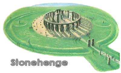
New research is suggesting that Stone Age Britons were arranging hilltop monuments in an elaborate grid of isosceles triangles?allowing travelers to navigate the country without maps. Apparently, these markers included famous sites like Stonehenge and The Mount.
Basically, these stone markers were a like a primitive GPS?and the accuracy was quite astounding. Researcher Tom Brooks explains:
'The sides of some of the triangles are over 100 miles across on each side and yet the distances are accurate to within 100 metres. You cannot do that by chance.
(b) Stone Age satnav: Did ancient man use 5,000-year-old travel chart to navigate across Britain
By David Derbyshire
http://www.dailymail.co.uk/sciencetech/article-1213400/Ancient-man-used-stone-sat-nav-navigate-country.html
The complex network of stones, hill forts and earthworks allowed travellers to trek hundreds of miles with 'pinpoint accuracy' more than 5,000 years ago, amateur historian Tom Brooks says. The grid covered much of southern England and Wales and included landmarks such as Stonehenge and Silbury Hill, claims Mr Brooks, a retired marketing executive of Honiton, Devon.
He analysed 1,500 prehistoric sites in England and Wales and was able to connect all of them to at least two other sites using isosceles triangles - these are triangles with two sides the same length.
This, he says, is proof that the landmarks were deliberately created as navigational aides. Many were built within sight of each other and provided a simple way to get from A to B.
For more complex journeys, they would have broken up the route into a series of easy to navigate steps.
Anyone starting at Silbury Hill in Wiltshire, for instance, could have used the grid to get to Lanyon Quoit in Cornwall without a map.
Mr Brooks added: 'The sides of some of the triangles are over 100 miles across, yet the distances are accurate to within 100 metres. You cannot do that by chance.
Theory: Stone Age People had Sophisticated Navigation Networks
http://www.physorg.com/news172480666.html
September 18th, 2009 by Lin Edwards
Prehistoric man 'used crude sat nav'
http://www.telegraph.co.uk/news/uknews/6189320/Prehistoric-man-used-crude-sat-nav.html
3. Other Sources Saying that the Megaliths Described Pathways
"Brit-Am Now"-922
http://britam.org/now/922Now.html
#2.The Dolmen Path - Dolmens Describe Roadways?
See also:
Megalithic Monuments may serve as proof of the Migratory paths of the Israelite Exiles.
For a Map and List of Israelite Migratory Routes see:
http://www.britam.org/Questions/QuesHistory.html#Migratory
For more maps of the Megalithic Trail of Migration see:
http://www.britam.org/Proof/Attributes/roleDolmen.html
There is much archaeological evidence some of which we have quoted in the past.
http://www.britam.org/Questions/QuesArchaeology.html#Stonehenge
Dolmens and the Bible
http://www.britam.org/Proof/Attributes/roleDolmen.html
Answer to Queries on Archaeology Question no.3:
"What do Dolmens and other megalithic monuments such as Stonehenge tell us?
http://www.britam.org/Questions/QuesArchaeology.html#Israel
 |
Skewes Jewelry 
|
 |
 |
